
A line in the sand: Westport seeks defense plan for its barrier beaches
WESTPORT —Once fearsome Hurricane Irene had lost much of its punch by the time it reached the Eastern Massachusetts coast back in 2011 — in fact the storm no longer even qualified as …
This item is available in full to subscribers.
Please log in to continue |
Register to post eventsIf you'd like to post an event to our calendar, you can create a free account by clicking here. Note that free accounts do not have access to our subscriber-only content. |
Day pass subscribers
Are you a day pass subscriber who needs to log in? Click here to continue.
A line in the sand: Westport seeks defense plan for its barrier beaches


WESTP{ORT — Once fearsome Hurricane Irene had lost much of its punch by the time it reached the Eastern Massachusetts coast back in 2011 — in fact the storm no longer even qualified as a hurricane.
But Irene scarcely seemed diminished down at Westport’s East Beach.
There the storm ripped East Beach Road to pieces, uprooted utility poles, sheds, decks and other left-behinds on the trailer lots, and dumped some of it into The Let on the far side of the barrier beach.
The town later rebuilt the road, creating a detour away from the sea by squeezing the route as far north as possible. That road, and everything else on the strip — in fact that barrier beach itself — exist on borrowed time.
Time running short
To better understand what this most vulnerable place faces in times of rising seawater, and in the hope of finding ways to protect and prolong it, Westport has embarked on the East Beach Corridor Vulnerability Study. A committee has been formed, two consultants — Woods Hole Group and Kleinfelder — have been hired, and community input is being sought.
It’s all part of a statewide effort — the state pays for 100 percent of the planning, 75 percent of action projects that may result.
“I hope this process leads to our citizens in the neighborhood and beyond becoming informed about what sea level rise and increased storms mean for our coastal community,” said committee Chairman and Planning Board member John Bullard. “That is what we have done to date. Next we will lay out possible actions we can take to increase our resiliency to these threats. The Commonwealth has a major investment in Horseneck Beach and we will hope to recruit their assistance increasing resilience into our beaches, dunes, roads and power grid.”
Joseph Famely, senior environmental scientist with the Woods Hole Group, reported recently on the first phase of the effort — Task 1, information on the beach’s history and present situation. The next task is to analyze the vulnerability of the East Beach corridor, and the final task will investigate ways the town can adapt and protect itself, and what such steps might cost.
It is hoped that this project will produce “adaption alternatives” that will help:
• Maximize the useful life of East Beach Road and its utilities
• Address access routes in the event of a beach and rode great at the Let
• Protect property and infrastructure along the East Beach Corridor
• And protect seasonal trailer homes on East Beach.
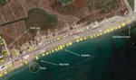
From end to end, “The total barrier system has about 80 homes, a major boatyard, a restaurant and seasonal trailers on the East Beach segment,” the study’s introduction states.
“There are only two emergency escape routes from this barrier system, the Route 88 Fontaine Bridge and the historic easterly connection to Horseneck Road. But there is only one source of power, telephone and telecommunications for these developed properties and that is across East Beach on poles. The beach is frequently over-washed from winter nor’easter storms.”
East Beach - Disappearing fast
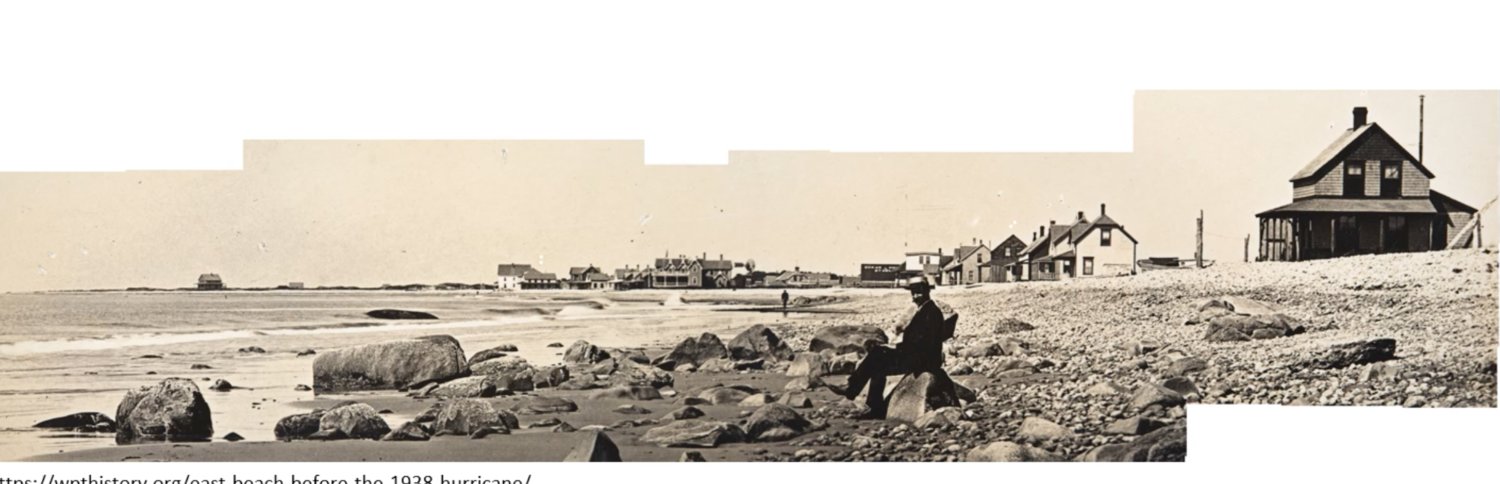
East Beach was once a bustling stretch of houses and even hotels, Mr. Famely said, until the 1938 hurricane and its 14-foot storm surge wiped the beach clean, dumping buildings far up the Westport River.
People tried to rebuild but those efforts were doomed by hurricanes — in 1944 and again in 1954 when Carol destroyed everything on East Beach.
Westport and the state had had enough after Carol, Mr. Famely said. Horseneck Beach went into the public trust and East Beach became a place of seasonal trailers, all hauled away when storms threaten and in the colder months.
But the damage continues.
East Beach (Horseneck too), is getting smaller with each passing year, Mr. Famely said, and the progress is relentless.
Showing a graphic with colored lines marking the locations of the water’s edge past and present, he said, “From 1990 to 2013, East Beach has eroded at a rate of from one half inch per year to almost two inches per year.”
That process is almost certainly bound to accelerate with sea level rise, he said.
By 2030, just a decade from now, sea level rise here is expected to be 1.2 feet; by 2050, waters are expected to rise by 2.5 feet; by 2070, 4.3 feet, and by 2100 (80 years from now), it is believed that waters will have risen nearly 8 feet.
By then, he said, even the routine “annual storm” will inundate almost all of East Beach, along with stretches of John Reed Road and Westport Harbor, beneath feet of water. The “100-year storm” will be flood vast areas.
Already, rising water and a receding shoreline, have changed East Beach.
Mr. Famely showed an old photo of a main sitting on an East Beach rock, with houses in the background. Further down by the water’s edge, cobble gives way to sand.
“The veneer of sand is still there,” he said, “it shifts around a lot (but) it’s mostly further out … Erosion has been getting worse in recent years, it’s now mostly cobble and coarse gravel,” and the beach is becoming shorter and steeper.
East Beach, and Horseneck as well, he said, are victims of “sediment starvation.”
The sediment that once supplied East Beach came from Gooseberry Island, he said, but Gooseberry used to be much larger.
Today, Gooseberry has eroded to a fraction of its former size, thus “East Beach is sediment starved. There is no longer a sock of sand feeding East Beach.” Some are convinced that the causeway is a lead culprit.
Asked why residents who don’t own a trailer down at East Beach ought to take an interest in the study, committee member R. Michael Sullivan replied, “ The barrier island is home to several beaches that are heavily used by Westporters (Horseneck, Baker's, East Beach and Cherry & Webb Beach). We have a vibrant boat yard with hundreds of customers and at least two busy restaurants. It is a beautiful place, a big draw card for the town and we hope to keep it that way and continue to facilitate people living and visiting for many decades to come.”
“Any Westport resident who has ever used any of the beaches like Cherry & Webb or Horseneck and noticed the sand giving way to cobbling has an interest in this study,” Mr. Bullard said. “Any resident who enjoys a meal at the Back Eddy or uses Tripp’s Boatyard and might be concerned about road access or loss of power for an extended period has an interest in this. We all want safe access to these beautiful barrier beaches and we want them as resilient to rising sea levels and storm surge as possible. We should all take an interest.”
It’s global warming — what’s a town to do?
Asked what one town can do in the face of global warming and sea level rise, several participants said that, while Westport certainly can’t stop sea level rise, there are steps to be taken that can slow the impact.
Moving utilities, rethinking road routes and perhaps doing something about that Gooseberry causeway are among the measures mentioned early on.
“As with many solutions to the global warming crisis, the sooner we act, the less drastic will be the steps we have to take,” Mr. Bullard said. “The first step is to become informed of the threats. Next is to understand what is the range of actions available to us and what are the costs and benefits. From that we can make decisions as a community. The next phase of the project will involve looking at actions we can take.”
“There is no doubt that sea level rise, left unabated, will potentially overtake much of our coastline,” Mr. Sullivan said. “Even if only a small fraction of the land-borne ice melts (mostly in Antarctica and to a lesser degree Greenland and many other glaciers around the world) we will have many feet of sea level rise (around 200 feet is possible if it all melts).”
“The challenge that this committee has is to balance the timeline of sea level rise against here and now actions that can be taken to offer property owners and other citizens decades of enjoyment of the barrier island prior to engaging in a retreat. … I don't think we have anyone on the committee that denies the scientific relationship between (carbon) in the atmosphere and rising temperatures. I think most of us are left guessing though, at what rate will the glaciers melt.
“The barrier island has suffered erosion on both the East and West Beach side over the past 90 years that we feel is directly attributable to the causeway,” Mr. Sullivan said, adding, ”We have made great strides in getting those in the business to recognize this assertion which is progress. Interestingly, some have attempted to minimize the relevance of this problem by pointing to sea level rise.”


