
State announces response plans as winter storm looms
East Bay area is expected to see lesser accumulations
PROVIDENCE — The administration of Gov. Dan McKee and the Rhode Island Department of Transportation have issued plans to respond to a potential high-impact, long-duration winter storm forecast …
This item is available in full to subscribers.
Please log in to continue |
Register to post eventsIf you'd like to post an event to our calendar, you can create a free account by clicking here. Note that free accounts do not have access to our subscriber-only content. |
Day pass subscribers
Are you a day pass subscriber who needs to log in? Click here to continue.
State announces response plans as winter storm looms
East Bay area is expected to see lesser accumulations
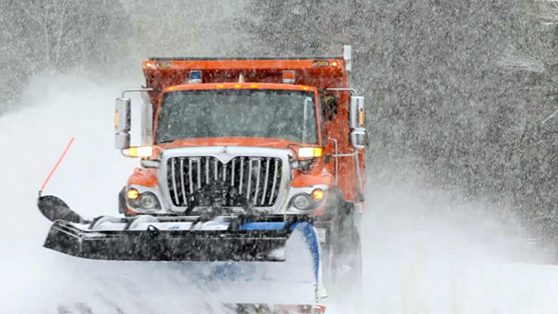
PROVIDENCE — The administration of Gov. Dan McKee and the Rhode Island Department of Transportation have issued plans to respond to a potential high-impact, long-duration winter storm forecast to impact the area over the next two days, March 14 and 15.
Following steady, occasionally heavy rain overnight tonight into Tuesday morning, precipitation is expected to change to snow from north to south during the day Tuesday, continuing into Wednesday morning. Snow totals will vary across the state, with parts of northwestern Rhode Island forecast to receive up to a foot of heavy, wet snow, while southern Rhode Island may only see 1 to 3 inches of snow.
Gusty winds inland ranging from 40 to 55 miles per hour are likely Tuesday evening, with winds diminishing further west. Heavy, wet snow accumulation and gusty winds may result in difficult travel and possible power outages. With heavy winds forecast, make sure to secure any outdoor objects.
(Stay up to date on the latest school and organization closings here...)
Here is how Rhode Island is preparing for the approaching winter weather:
- RIDOT has their plow fleet ready for the storm, with trucks in top operating condition and loaded with salt.
- RIDOT has 150 state trucks and more than 250 vendor trucks ready. RIDOT is also fully stocked with 65,000 tons of salt available for the roads.
- RIDOT crews will be available this evening to deal with any issues associated with heavy rainfall.
- RIDOT staff will be in for their normal shift on Tuesday as the switchover to snow occurs. Crews will remain on Tuesday evening into early Wednesday morning.
- RIDOT will also have crews ready to deal with any fallen limbs or trees blocking roads, and has access to vendor tree crews to assist.
- Rhode Island Emergency Management Agency is in communication with local EMA departments to ensure communities have the necessary supports in place.
- The Department of Housing has communicated with shelter providers and warming centers about the storm and has requested that they implement emergency shelter plans.
- Rhode Island State Police will be monitoring the highways and assisting motorists if needed.
- The Office of Energy Resources is in contact with Rhode Island Energy (RIE) and the state’s delivered fuel terminals to closely monitor the incoming storm system and its impact on power and fuel supplies across the state. RIE will have additional utility crews standing by.
- OER has reached out to the delivered fuel (heating oil, diesel, gasoline, propane) terminals and will monitor the situation as the storm progresses.
- RIE has secured an additional 139 external line and 95 tree crews in addition to their full team of 53 internal line crews and Rhode Island Energy employees, which includes underground, wires down, damage assessment, customer service and hundreds of back-office personnel supporting the response effort.
Tips for motorists during this winter storm – at this time, weather is expected to most significantly affect the Tuesday afternoon commute:
- Plan additional time for travel and avoid unnecessary travel during the heaviest snowfall
- Never drive through a flooded roadway
- Reduce speed – most of the crashes and disabled vehicles we see during winter storms involve people driving too fast for the conditions
- Provide plenty of stopping distance in front of you
- Avoid distractions – don’t text; put the cell phone away
- Stay safe, buckle up and don’t drive impaired
- Don’t crowd the plow or pass plow trucks – plow drivers have limited visibility and maneuverability
- The safest place on the highway is behind a plow truck


