
Two maps and a lot of town history in Barrington
Senior project yields map of town; historical lecture highlights map from 1771
Barrington High School senior Lindsey Hands spent much of her April school vacation coloring — not for fun but as part of her senior project.
Lindsey has created a map of the Town of …
This item is available in full to subscribers.
Please log in to continue |
Register to post eventsIf you'd like to post an event to our calendar, you can create a free account by clicking here. Note that free accounts do not have access to our subscriber-only content. |
Day pass subscribers
Are you a day pass subscriber who needs to log in? Click here to continue.
Two maps and a lot of town history in Barrington
Senior project yields map of town; historical lecture highlights map from 1771
Barrington High School senior Lindsey Hands spent much of her April school vacation coloring — not for fun but as part of her senior project.
Lindsey has created a map of the Town of Barrington identifying certain points of interest and those with historical value. She will unveil her map on Monday, April 30 at a Barrington Preservation sponsored event at the public library.
Lindsey got the idea of creating a map from a distant relative after her family inherited a map from the 1920s of Rutherford, NJ that has notable buildings and points of interest detailed around the boarder.
“When we got the map, I thought it would be cool to do a similar one of Barrington and thought it would make a good senior project," she said. "I remember back in third grade when we were given a booklet on the history of Barrington. I still have it and always thought the history was interesting."
Lindsey enlisted the help of Barrington Preservation Society President Nathaniel Taylor to act as her mentor and then she got to work.
She found a suitable, generic map of the town and began by putting a grid over it, plotted points, and left room around the boarder for text.
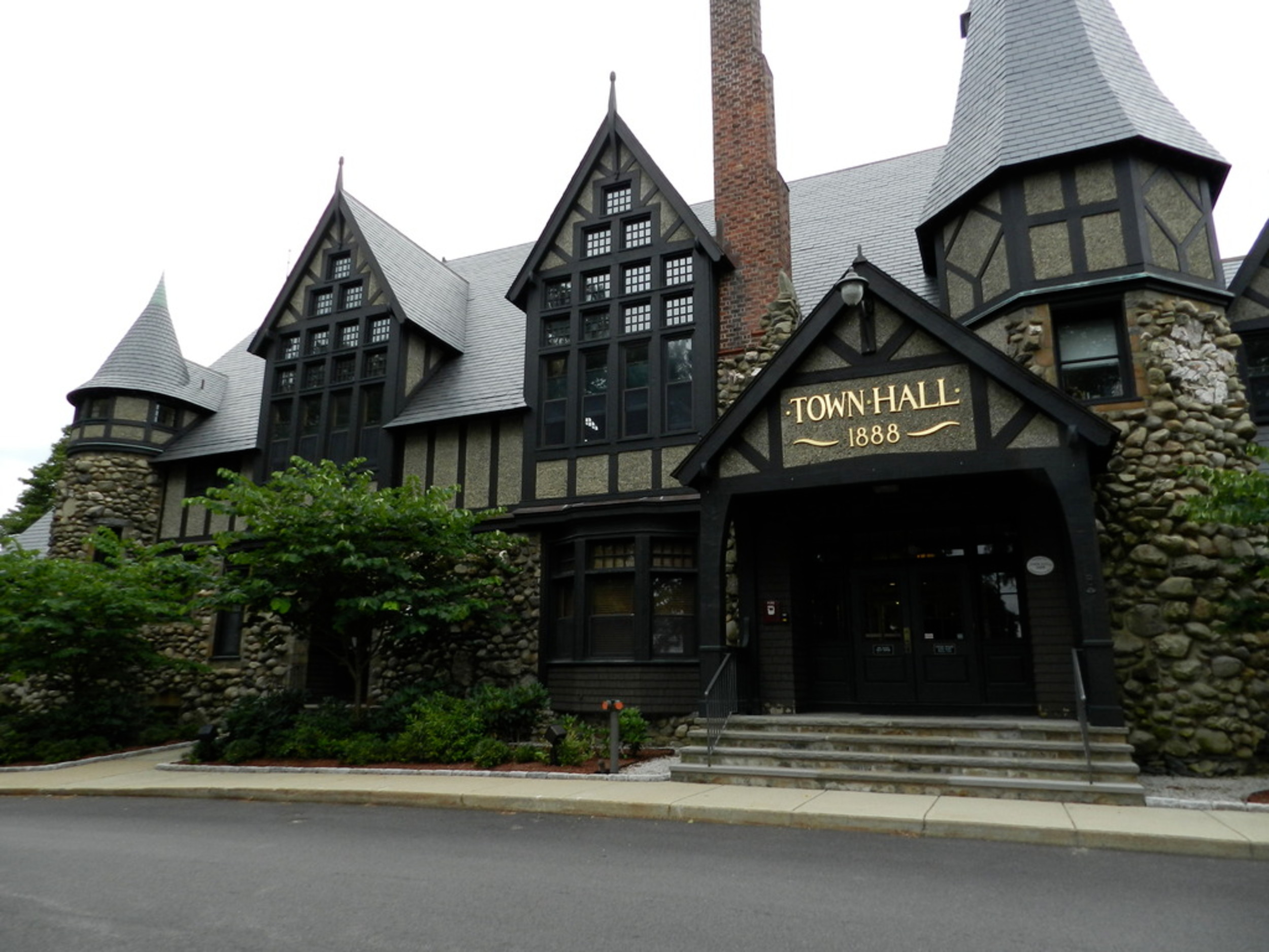
She has detailed Barrington’s “greatest hits” or notable landmarks such as the White Church, Nayatt Point lighthouse, the town hall, the railway (now East Bay Bike Path), the former Zion Bible College property and more.
The hand-drawn map is about 2-feet-by-3-feet in size and has taken up her family's dining room table for months. In fact, she estimates spending upwards of 40 hours on the project.
“It’s been a bit more involved than I anticipated. The coloring is time consuming,” she said.
Mr. Taylor said he was impressed with Lindsey’s concept and has been pleased with her determination.
“Lindsey has made a map of Barrington embellished with sketches and short descriptions of important people, places, and moments in our history. Lindsey's map is handmade, an old-fashioned product, a handmade complement to Lindsey's interests and strengths in computer programming and digital media. Doing it slowly, by hand, Lindsey has certainly learned a lot about Barrington's history and geography. We hope others will enjoy the map she has made,” Mr. Taylor said.
The Barrington Preservation Society will gladly work with any students who take an interest in this town's history. There are many ways to be involved and many possible projects to do. It is a great way to build a skill, work with others in the town, and learn more about this place, he added.
The map will be presented before a lecture by Barrington historian Van Edwards on the rise and fall of Barrington’s historic town center — the area immediately north of the current Barrington Congregational Church, also known as the "White Church." The event will be held on Monday, April 30, at 7 p.m. at Barrington Public Library in the Salem Family Auditorium & Collis Family Gallery.
The lecture will focus on the area that began to grow in 1737 with the removal of the Congregational Church from an earlier location on Jenny's Lane, and how the railroad shifted the town’s center away from the Old Village in 1860.
Mr. Edwards will show and discuss a map that was drawn for tavern-keeper Henry Bowen in 1771, documenting house lots, taverns, a schoolhouse, and blacksmith shop in this bustling village on the eve of the American Revolution.
The event is free and refreshments will be served following the lectures.


